The first GPS steering system from Claas was introduced in 2003 and since then the company has developed a full
range of steering systems offering a range of precision to suit different needs. It now offers three different terminals for use with GPS steering and machine management systems: GPS CoPilot TS; GPS Pilot S3 and Cebis Mobile.
The Claas CoPilot TS steering terminal provides a cost effective option for those looking to start making use of GPS steering. It has been designed for use with tractors and shares many features of the more advanced S3 control unit. Using an Egnos correction signal giving a level of accuracy of 15-30cm and capable of following a straight or curved path. CoPilot TS can be used for either steering guidance using an integrated lightbar or can be upgraded for use with an automatic steering system.
The CoPilot TS unit incorporates a large touch screen display and aside from providing track management, the terminal can be used to calculate and store information, such as the area covered, and has a USB connection to download information for further use.
 |
The Claas GPS CoPilot TS steering terminal provides a cost effective option for those looking to start making use of GPS steering. |
A new feature for 2011 is compatibility with Claas Agro-Map mapping software. Having saved yield mapping data from the combine, via CoPilot TS it will now be possible to also save information from the tractor, such as A-B lines, drill or tramline settings and so on in the same folder.
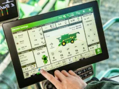
The latest Claas GPS Pilot S3 terminal provides a more comprehensive range of information and incorporates an 8.4-inch touch screen display. In addition to A-B line set-up and following, other functions include internal job-management, area calculation, markers and data exchange with Agro-Net and Agro-Map software.
This new version of the terminal is not only faster to respond than previous units, but is more positive and uses a six-axis gyro so that not only can side-to-side movement be compensated for, but also pitch and yaw.
The new GPS Pilot II system is the first system to be designed and built by Claas and can be used in conjunction with Egnos, OmniStar HP, Baseline HD and RTK signals. It is used via the Cebis Mobile multi-functional terminal that can also be used to set-up and operate Isobus-compatible machinery or for variable-rate application. Information is displayed on a 6.4-inch colour display and the terminal incorporates the standard Isobus layout with 15 keys and one rotary switch for easy navigation.
The GPS Pilot II system is designed for use with the Lexion 620 to 770 combine range and Xerion 5000 or 4500 tractors, and this will be extended to Xerion 3300 and 3800 models later next spring.
GPS Pilot II is designed so that it can be quickly and easily moved from one GPS-ready machine to another, with all the main components contained in a simple tray that slots into a mounting beside the driver’s seat.
When used for GPS steering, in addition to straight A-B line and parallel contour following, there is also the ability to set a curved A-B Contour path that allows bout skipping, plus there is the ability to set an A-B path that can be shared by two machines, such as a combine and accompanying chaser bin.
RTK network
Since the announcement in the spring of 2010 that Claas was establishing its own network of RTK masts in the UK, the firm now has 11 masts in operation in East Anglia, Lincolnshire, Nottinghamshire and Leicestershire, providing coverage for about 2.4 million hectares.
Work is now progressing on a new network for the Kent area, which is planned to be operational by the end of the year, which will cover 400,000ha.
This, combined with the existing network, will provide comprehensive coverage for nearly 3.0 million hectares from the English Channel to the Humber.
For more information visit: www.claas.com.


