The wealth of output and management information available from Claas’ Telematics combine management and monitoring system has proved so useful to operators that the company has extended its availability to its larger tractors and Jaguar foragers.
Launched in 2005, until now Telematics has only been available on top-of-the-range Lexion and Tucano 480 combines.
However, for 2011, availability has been extended to cover:
- Lexion 620 – 770 combine harvesters
- Lexion 510 – 600 combine harvesters
- Tucano 320 – 480 combine harvesters
- Jaguar 930 – 980 forager harvesters
- Xerion 4500 and 5000 tractors
- Axion 810 – 850 tractors (from Spring 2011)
- Xerion 3300 and 3800 tractors (from Spring 2011)
This considerable expansion in the availability of Telematics will now bring the monitoring, management and output data gathering benefits of the system to a far wider range of machinery. This, in turn, will help farmers and operators better manage machinery and identify areas where machinery efficiency can be improved, and cost saved.
As part of this expansion in Telematics availability, a number of specific new features have been designed appropriate to the machinery involved. In addition to the wealth of information already available to combine operators, for 2011, in addition to the yield mapping options already available, Lexion or Tucano operators will now also be able to create maps showing either sieve or rotor losses; grain moisture variation or engine load.
For forage harvesters, in addition to storing and being able to view all current machine settings and the machine location using Google Earth, a range of maps can be created and viewed showing either crop yield, dry matter, fuel consumption, engine load or chop length.
An additional feature available to Jaguar and Lexion 620-770 users is a new Task Management function. Each task (a farm or individual fields) is allocated a number and having pulled up the Task Management folder, by clicking on the number either the current or historical job data, such as duration, area, and so on, can be viewed.
As with combine and forage harvesters, Telematics for the Xerion 4500/5000 and Axion range will show all the current machine settings and performance data, while maps showing either engine load or fuel consumption can be created and overlaid on Google Earth.
The Claas Telematics system relies on the use of both GPS satellite and GPRS cellular technology to create a two-way link between the machine and a dedicated website, which the owner can then access from either a computer or hand-held web-enabled device.
In operation, the Telematics unit on the combine, forager or tractor will take a record of the machine’s location, settings and output state every 15 seconds, which it then stores on a chipcard. Then, every 15 minutes, the unit will automatically ‘phone the web server and upload the latest information. In the event of a signal not being available, the information will be stored and uploaded when the next connection is made.
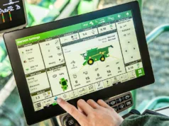
Information from up to three machines can be viewed at a time, and among the wealth of information stored, all the current settings and output performance data can be seen and compared on an hour, day or work to date basis. In addition, real-time maps can be stored and the combine’s position seen using Google Earth.
Also, with theft of high-value tractors becoming an increasing problem, if working away from its main base, the machine’s location can be ring-fenced beyond which it won’t move, or in the event of theft its location can be monitored.
For more information visit: www.claas.com.


