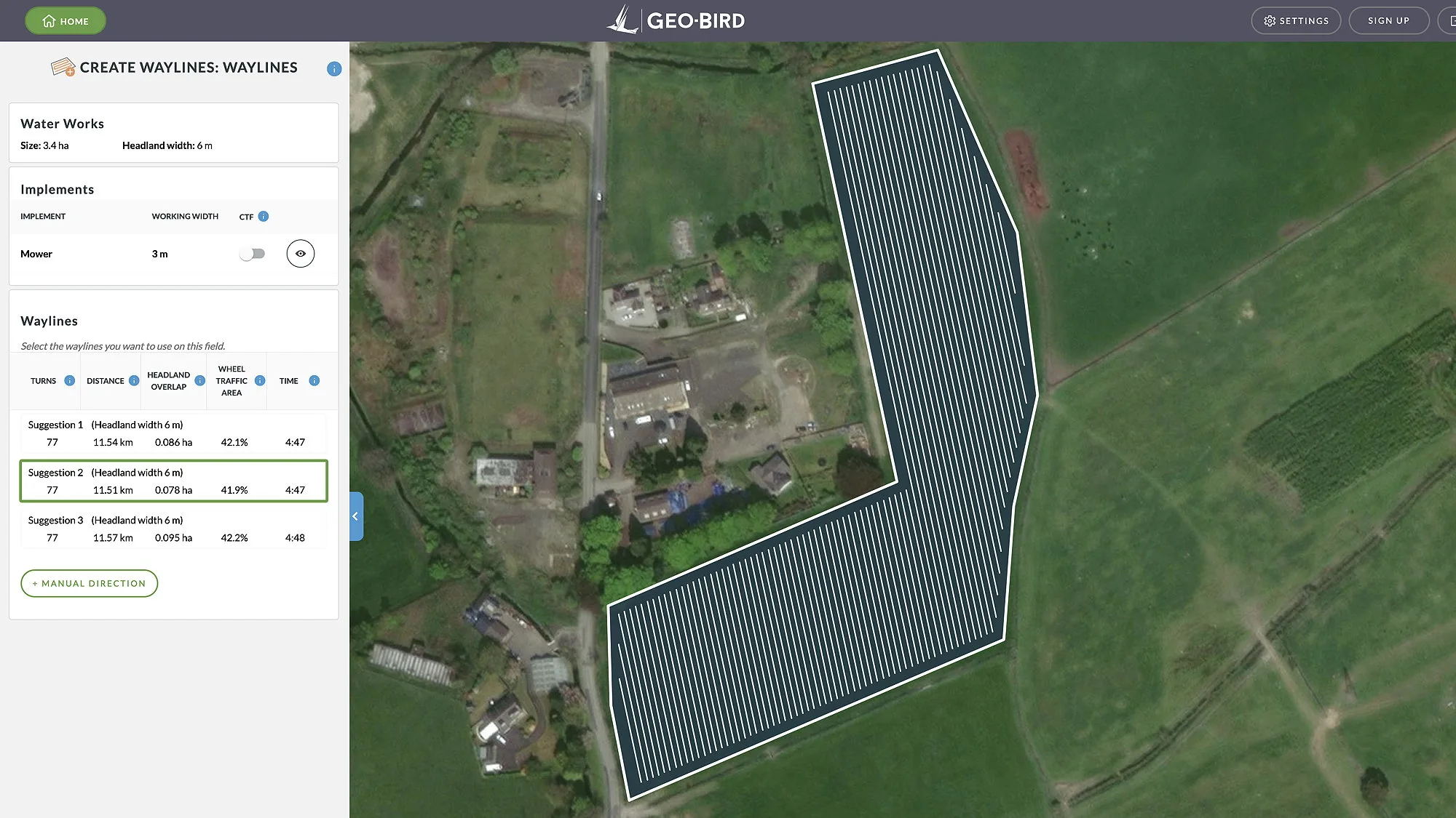
The app lets users draw field shapes directly onto a satellite image of the farm, or to import boundaries from an existing work file, before outputting three suggested wayline paths for working the field efficiently.
For each option, the distance travelled and working time (based on the implement speed) is shown.
Fields can be created and saved, as can implements. The waylines are created based on the field shape and working width of the implement you want to use based on the following parameters: turns, distance, headland overlap and wheel traffic area.
A controlled traffic farming (CTF) function will even align the generated waylines for different implement widths used in the same field.
There’s also the ability to generate your own custom waylines.
The results can be saved to the cloud directly from the app, or downloaded, in all Agco formats, as XML files or in a number of different multibrand formats.


