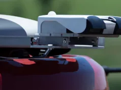
New Holland is taking the technological initiative with its revolutionary new approach to Precision Land Management (PLM). Not only is it fitting its IntelliSteer integrated differential global positioning system (DGPS) guidance to many more of its machines as factory fit, but CNH – working with its world-renowned partner Trimble – is now the only tractor manufacturer able to supply after-market integrated DGPS kits for competitive brands of tractor.
The accompanying software for these systems now means that fleets of machines – combines and tractors – can effectively ‘talk’ to one another and share detailed information using a powerful blend of New Holland’s own software, the latest global mapping technology and a USB memory stick.
New Holland’s own IntelliSteer system can currently be fitted to the T6000 Range Command/Power Command Sidewinder II tractors, all the T7000, T8000 and T9000 tractors as well as CX and CR combines. Later this year, it will also be available for other selected models within the T6000 range.
Not only will more of the New Holland range now have factory-fitted DGPS guidance options, but by using its Global Partnership with Trimble, New Holland is making it possible to supply Trimble’s Auto-Pilot fully integrated guidance systems to competitive machines including combines. This provides many advantages over the more common bolt-on assisted guidance systems available.
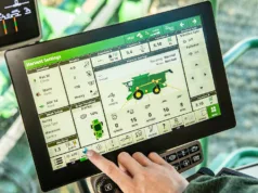
The Trimble system, in conjunction with the FM-1000 TouchScreen monitor, can use a second receiver placed on the trailed implement providing automatic trim, thus decreasing overlap and misses – maximising efficiency and profitability. This is particularly useful when the tractor is working on side slopes and trailing machinery.
New Holland’s Dan Halliday said layers of technology were being combined to create a farming revolution.
“The equipment now available is truly awesome. The fact that we now have this amazing technology at New Holland that’s not only powerful, but compatible to many competitive machines, is probably one of our best kept secrets,” he said. “It effectively means that a precision farmer can sit in his office and, using our Precision Farming Software, load information on yield, moisture, fuel usage and so on and then overlay this data onto Google Maps to show the surrounding area. He can create swath lines, save, change and export them on the software and can then transfer them to other machines using a memory stick.
“The software can calculate the most efficient way to harvest a field while boundaries and headland guidance lines can also be created and manipulated. Multiple machines can be supplied with the same information – so, for the first time, the information and the technology is being truly linked up – excellent technology all aimed at increasing our customer’s efficiency and therefore profitability.”
For more information on New Holland’s Precision Land Management Technology, visit www.newholland.com/.


