Using next-generation positioning technology, the Topcon System 150 represents superior value for today’s farmer. On-screen visual aids, including the optional detachable lightbar and easy-to-read coverage maps, provide job information for complete application accuracy. A number of automatic-steering-ready tractors are also supported by the unit.
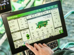
The System 150 Automatic Steering system has features such as boundary and U-turn recognition to make it easy to complete your turns and lock-on to the next swath. The guidance dashboard provides on-screen indicators for area applied, speed, row number and satellite information, while building a colour coverage map.
Lightweight and portable, the System 150 is simple to move from vehicle to vehicle. And by using the USB port you can easily transfer the file with field notes to your computer for printout.
The System 150 also provides three basic modes that can be used in a variety of combinations, allowing you to easily work with virtually any field shape.
Boundary mapping enables you to create an outline of your field that you can then use for any application job that you perform on that field. Knowing the size and shape of your field will help to plan your application quantities and coverage route.
Once you know the area of your field, coverage mapping can be used to track the area covered by your vehicle. Easily identify missed areas or identify areas of overlap. With the remote master hook-up, automatic coverage maps can be generated more accurately without additional work.
With optional ASC-10 Automatic Section Control, the System 150 will automatically switch from one to 10 sprayer sections on and off as you cross a previously applied area, saving chemical while protecting your crop.
The System 150 has market-leading vehicle and sprayer set-up settings to suit a variety of configurations including attached front and rear implements or single and double-trailed hitch points.
With fully integrated steering and inertial guidance gyros, Topcon’s G3 triple-constellation satellite receiver chip allows users to receive signals from all available satellites now and in the foreseeable future, instead of being limited to fixed patterns that may not be exactly right for your field. Topcon’s intuitive software allows you to quickly create and follow the most efficient or practical guidance.
System 150 Features:
- Multiple-constellation support for GPS, Glonass and Galileo global navigation satellite systems.
- Support for WAAS, EGNOS satellite-based augmentation services.
- Optional Omnistar VBS and Omnistar XP/HP subscription 450-470MHz UHF and GSM services.
- Optional detachable lightbar.
- Five-inch full-colour display with backlight.
- Multiple automatic steering modes including straight line, curves, pivot, and last pass.
- Adjustable LED settings.
- Ambient light sensor maintains sharp display.
- Quick action keys for simple operation.
- GPS status screen.
- Interchangeable field views including overhead and path view.
- On-screen status indicators including row number, speed and area applied.
- Functional zoom features for swath, guidance and field views.
- Simple on-screen set-up with visual aids including implement offsets.
- On-screen coverage logging.
- Coverage map report with field notes for simple file transfer via USB port.
- 2 x USB, 2 x CAN, 1 x RS232 and 1 x RS232/485 ports.
For more information call J&S Industries on 01572 823123.


